Drones at the Beach - Surf Zone Monitoring Using Rotary Wing Unmanned Aerial Vehicles
Abstract:
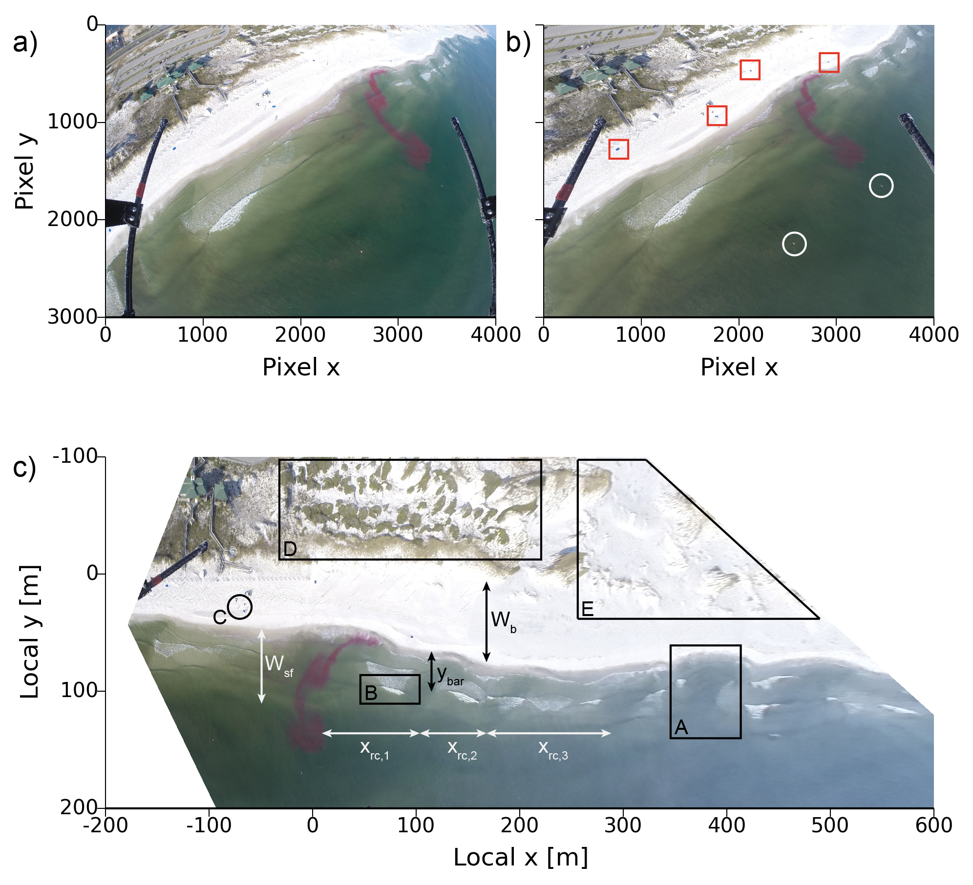
The images obtained from the UAVs (Fig. 1a), and in combination with surveyed Ground Control Points (GCPs) (Fig. 1b, red squares and white circles), can be geo-rectified (Fig. 1c) to pixel resolution between 0.01 - 1 m and a reprojection error, i.e. the difference between the surveyed GPS location of a GCP and the location of the GCP obtained from the geo-rectified image, of O(1 m). These geo-rectified images provide data on a variety of coastal aspects, such as beach width (Wb(x,t)), surf zone width (Wsf(x,t)), wave breaking location (rectangle B), beach usage (circle C) and location of dune vegegation (rectangle D), amongst others.
Additionally, the possibility to have consecutive, high frequency (up to 2 Hz) rectified images makes the UAVs a great data instrument for spatially and temporally variable systems, such as the surf zone. Our first observations with the UAVs reveal the potential to quickly obtain surf zone and beach characteristics in response to storms or for day to day beach information, as well as the scientific pursuits of surf zone kinematics on different spatial and temporal scales, and dispersion and advection estimates of pollutants/dye.
A selection of findings from several field experiments and using multiple optical instruments will be showed at the meeting, discussing the new possibilities rotary wing UAVs can offer for surf zone research.