Coastal hazards projections on the U.S. West Coast using a dynamic water level modeling approach
Abstract:
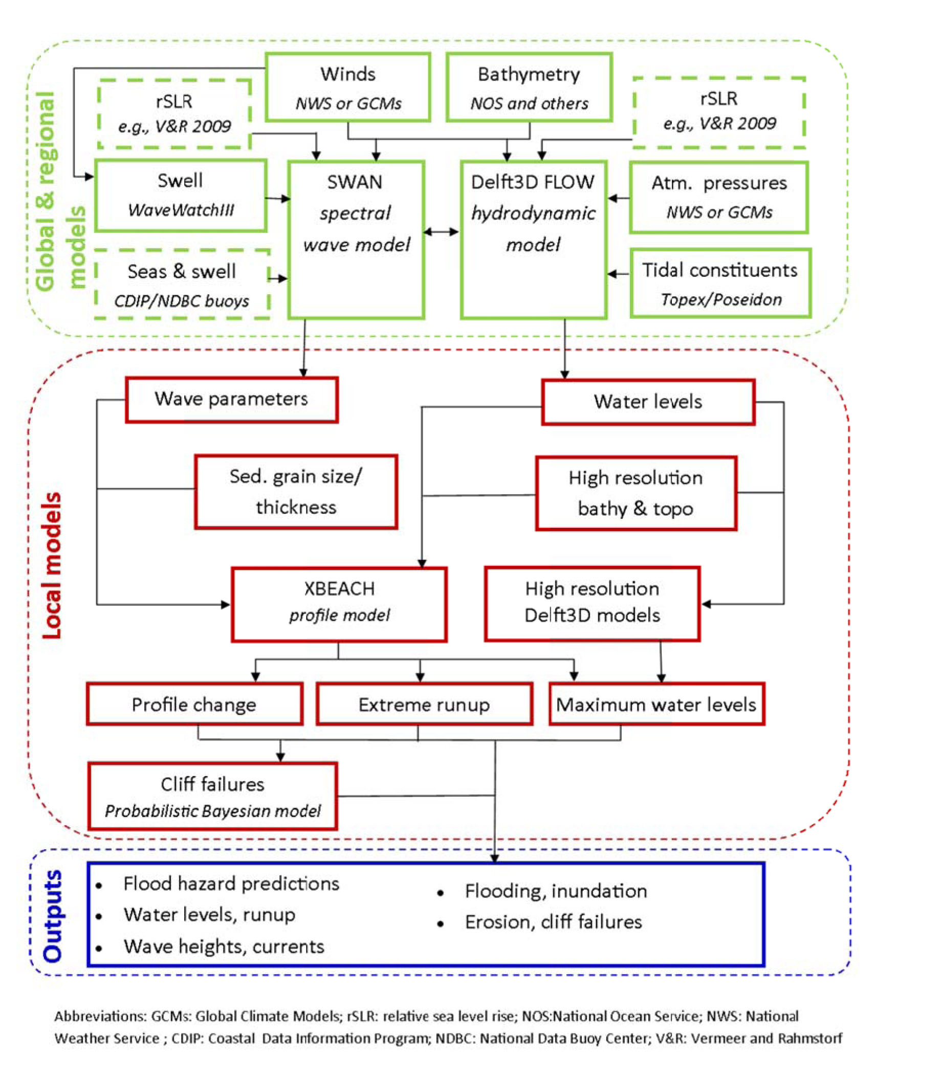
The Coastal Storm Modeling System (CoSMoS) is a numerical modeling system developed to predict coastal flooding due to both SLR and plausible 21st century storms for active-margin settings like the U.S. West Coast. CoSMoS applies a predominantly deterministic framework that encompasses large geographic scales (100s to 1000s of kilometers) yet models flood extents to a local resolution (2 m) so that storm related changes in water levels at the shore can be resolved. In the latest iteration of CoSMoS applied to San Francisco Bay, efforts were made to incorporate water level fluctuations in response to trapped coastal waves, low pressure systems, ocean swell energy penetrating through the Golden Gate, locally wind-generated waves, and backflow induced by river discharge. The end product is a web-based tool (www.prbo.org/ocof) where users can assess variations in flood extent, maximum flood depth, maximum current velocities and wave heights in response to a number of potential SLR and storm combinations, providing direct support for adaptation and management decisions. Future efforts in Southern California will feature a dynamic coastal DEM that evolves over decadal time scales to provide updated boundary conditions for future storm simulations.