Repeat-pass InSAR processing for Vegetation Height Calculation: Theory and a validated example
Abstract:
The determination of forest stand height (FSH), which is an assessment made on the order of one to ten hectares of resolution, InSAR can provide measures that are proportional to FSH. These are: 1.) interferometric phase compared to a known DEM, preferably of the bald earth, 2.) interferometric correlation (polarimetric or otherwise), which is related to the volume scattering nature of the target, and 3.) interferometric correlation which is related to the temporal decorrelation of the target. Of these, while the volumetric aspect of interferometric correlation is of keen interest, because of the dominant error source of temporal decorrelation, it comes at the cost of the need to perform single-pass interferometry. While such satellite systems do exist (notably the TanDEM-X mission), for vegetation applications, lower frequency systems such as ALOS-1 and -2, and the future NASA radar mission at L-band, provides better signal returns from throughout the vegetation canopy. Hence, rather than relying on volumetric correlation to provide the desired FSH signature, repeat-pass observations of temporal decorrelation are coupled with a vegetation model for this decorrelation to determine the vegetation height.
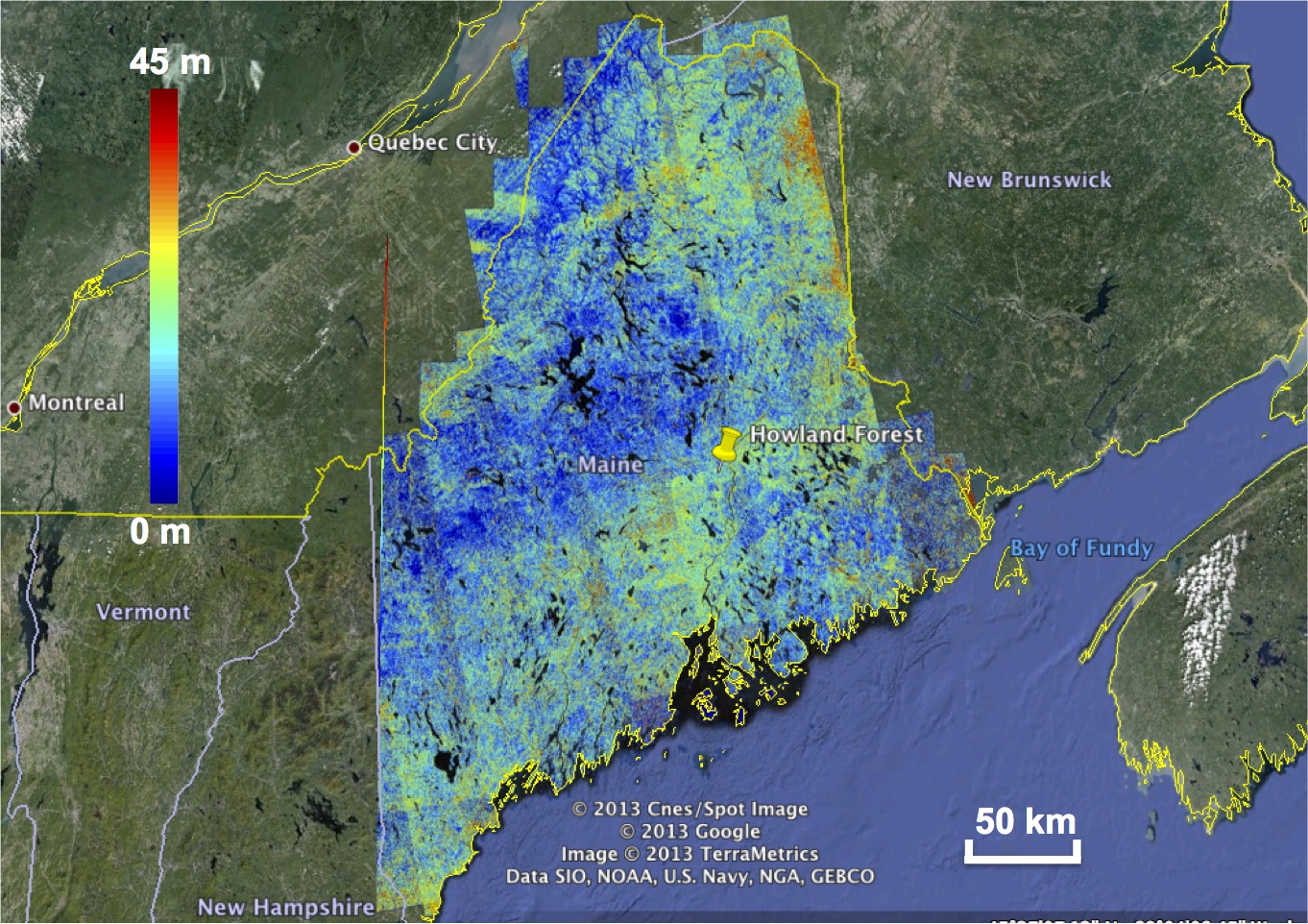
In order to demonstrate this technique, the University of Massachusetts has used 46-day repeat-pass ALOS data to estimate FSH over the US State of Maine, nearly a 10 million hectare region. The results have been validated using the LVIS lidar system and a map of vegetation height provided by Woods Hole Research Center. This talk will describe the process that was used for creating this map, and how the data processing was automated to account for differences in temporal decorrelation over this large study area.