Co- and post-seismic deformation for the 2014 Napa Valley Earthquake from Sentinel-1A interferometry
Abstract:
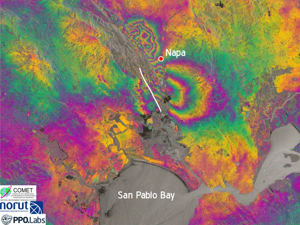
The 24 August 2014 Napa Valley earthquake was the first earthquake for which surface deformation was measured by Sentinel-1A, a new radar satellite launched by the European Space Agency on 3 April 2014, and operated by the European Commission’s Copernicus program. Sentinel-1A reached its final operational orbit on 7 August, and fortuitously acquired a pre-earthquake image of the San Francisco Bay area on that day in StripMap mode. By comparing it with an image acquired on 31 August, we formed a co-seismic interferogram, which reveals the surface deformation that occurred during the earthquake and the first 7 days of the post-seismic period. We use this to constrain a simple elastic model of the co-seismic slip distribution; preliminary inversion results show that the slip at depth reached a peak of >1.5 m at a depth of ~4 km.
Following the earthquake, Sentinel-1A has acquired further acquisitions in both StripMap and Interferometric Wide Swath modes. The first 12-day post-seismic StripMap interferogram shows a sharp discontinuity along the entire fault rupture, consistent with field observations of rapid afterslip. We will use the full time series from August to December to measure the spatio-temporal behaviour of the afterslip, and discuss the implications for the frictional properties of the fault.
The results from Napa point to an exciting and impactful future for the Sentinel-1 radar constellation. By mid-2014, Sentinel-1A will be acquiring data systematically over all the seismic belts, and the launch of Sentinel-1B in 2016 will increase the temporal frequency of acquisitions. The data will be available free of charge and will transform our ability to conduct tectonic geodesy, particularly in remote areas of the planet or developing countries unable to afford dense ground-based GNSS networks.