Aftershock Observation of the 2014 South Napa Earthquake and Shallow S-wave Velocity Structure Obtained by Passive Surface Wave Method at Three Sites
Abstract:
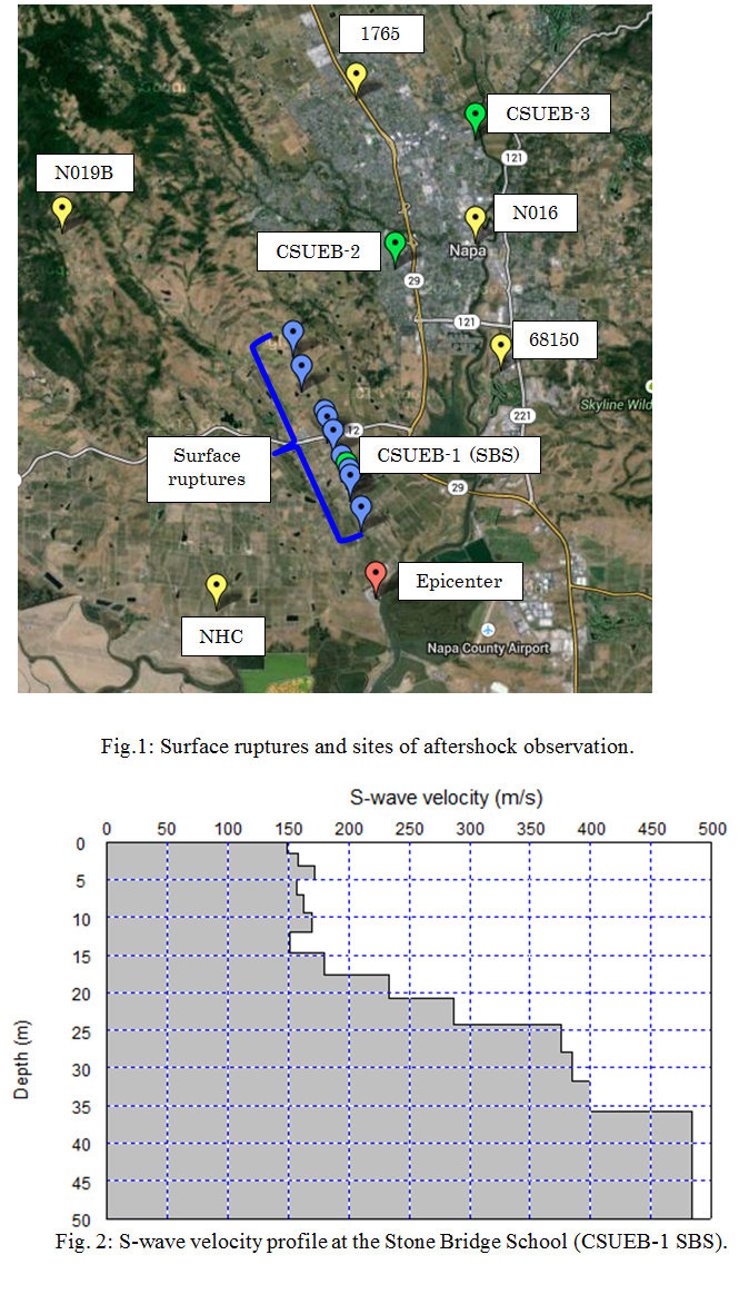
On the day of the earthquake, we confirmed surface rupture for at least 5 km. Seismographs were deployed at three locations the day after the mainshock; on east side of Napa Valley (CSUEB-3), the west side (CSUEB-2), and at Stone Bridge School (CSUEB-1 SBS), which is located directly on the line of surface rupture (Fig. 1). The seismographs recorded continuous data for two weeks. At least 60 aftershocks with magnitudes between 1.0 and 3.9 were recorded. Preliminary analysis indicates a difference in local amplification of horizontal ground motion for 1-5 Hz, with amplitudes on the west side of Napa Valley larger than those on the east side.
A passive surface wave survey using the two-station spatial autocorrelation (2ST-SPAC) method was conducted at each of the aftershock observation sites. At each site, one seismograph was established at a fixed location and recorded ambient noise for the duration of the survey. A second seismograph was placed at a series of different locations, with the distance from the fixed station ranging from 5 to 40 m. At each measurement location, ambient noise was recorded for intervals ranging from 5 to 20 minutes using a 10 ms sample rate, for a total of approximately one hour of data acquisition per site. The vertical component of ambient noise was used in the SPAC analysis to calculate phase velocity. Fig. 2 shows a VS profile at Stone Bridge School (CSUEB-1), which consists of two layers; the first with VS of about 150 m/sec and the second with VS of 400-500 m/sec. Depth to the second layer is about 20 m.