Vegetation Continuous Fields: The Evolution of Sub-Pixel Land Cover Mapping from AVHRR, MODIS and Landsat
French Title: Végétation Champs Continus: Évolution de la Cartographie de la Couverture Terrestre Sous-Pixel de AVHRR, MODIS et Landsat
Abstract ID#: 34363
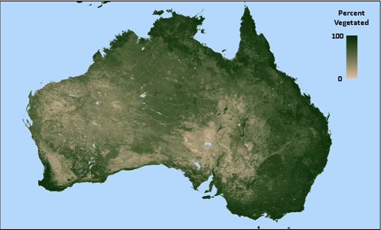
Mapping vegetation as subpixel fractions of biophysical types addresses short-comings of traditional land cover maps. Maps of Vegetation Continuous Fields (VCFs) capture gradations of landscape variability, such as those due to disturbance or subpixel patterns of nutrient and water availability. VCFs are inherently better suited to representation of gradual spatial and temporal changes in land cover, and offer improved estimation of biophysical parameters over large areas. They allow modelers greater flexibility in constructing parameterizations that directly depict driving factors in the landscape at a range of spatial resolutions, for example surface roughness.
The VCF depictions are unique and not furnished by normalized difference vegetation index (NDVI) and leaf area index (LAI) products. VCFs describe the heterogeneity of each pixel, differentiating, for example, between a pixel covered with sparse forest and a pixel covered with a mixture of forest, crops and bare ground. VCFs also quantify the subpixel proportions of tree cover, non-tree vegetation, bare ground and water found in each pixel.
Current VCF products are generated with four fractional layers: tree cover, non-tree vegetation, bare ground and water. Vegetation is further partitioned by leaf type (broadleaf / needleleaf) and leaf longevity (evergreen / deciduous). This presentation describes the evolution, lessons learned and application of VCFs over the past two decades from AVHRR (1°, 8 km, 1 km) to MODIS (500 m, 250 m) to Landsat (30 m) as well as current advances toward an inter-calibrated, multi-sensor, 30+ year data set at 1/20º. Through the VCF development history, methods have evolved from end-member mixture modeling to multiple regression trees with dynamic hands-off automated training. This evolution is described and current applications of the products are described. Funded by NASA via NNX14AJ33G and NNX13AJ35A.