Using Airborne Gravity Data to De-Risk Petroleum Exploration in Frontier Areas: An Example from the Cauca-Patia Basin of Colombia
Previously Published Material: A more seismically oriented presentation related to the same project was presented at the CSEG-EAGE Land Seismic Workshop in Banff, Sep. 23-25, 2014.
Abstract ID#: 34440
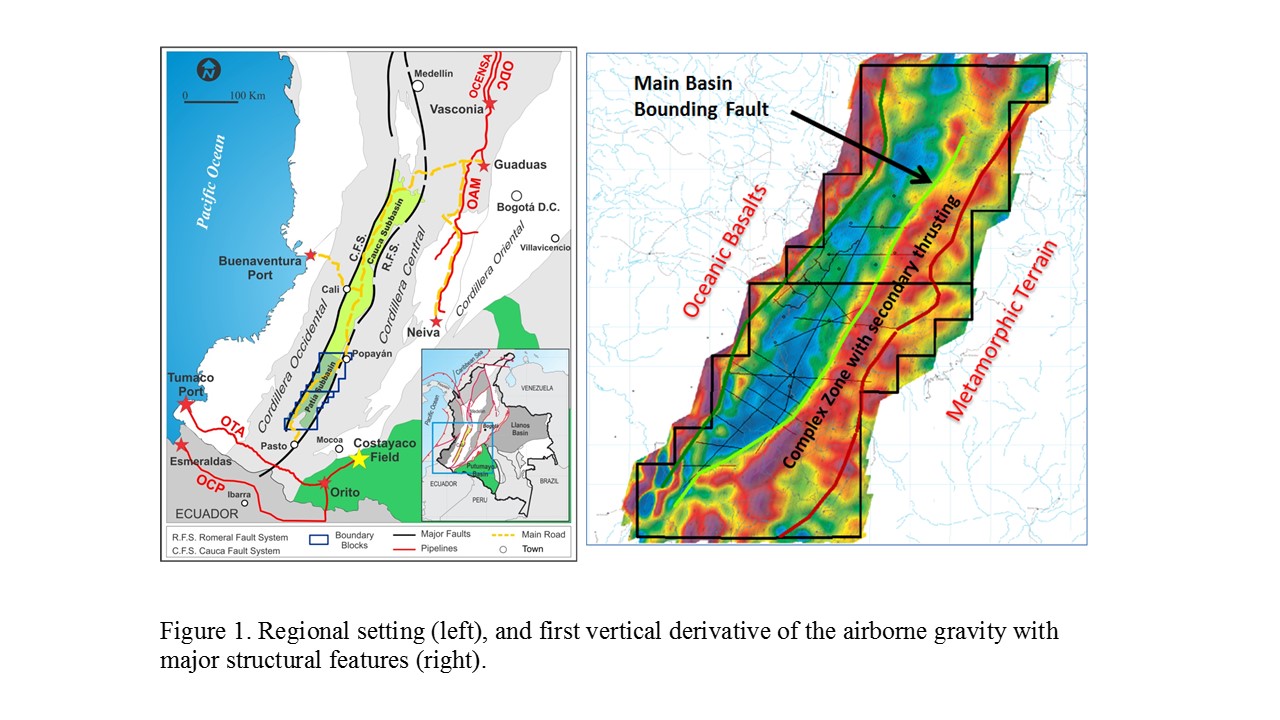
Gran Tierra Energy (GTE) has been actively exploring in several frontier areas, including the Cauca Patia Basin in Colombia (Figure 1). In 2012, GTE conducted an 8,757 line kilometre helicopter-borne aeromagnetic and gravimetric survey over the Patia sub-basin. The survey was flown and processed by Sander Geophysics Ltd. (SGL), and gravity data were acquired using SGL's airborne gravity system, AIRGrav (Airborne Inertially Referenced Gravimeter).
Results of the airborne survey are excellent, and the potential field data correlates closely with the basin boundaries and other mapped structural features (Figure 1). The potential field data were used along with surface geology to delimit the edges of the sedimentary basin and identify areas likely to result in inherently chaotic seismic data. The potential field data were also used to map areas where higher velocity material has been thrust over the lower velocity sediments, resulting in low velocity seismic zones. Conversely, the data were also used to indicate where lower velocity material is at the surface, in which case seismic imaging issues in these areas are likely the result of structural complexity rather than velocity inversions. Through an iterative analysis, the structural model was re-evaluated, resulting in the generation of a suite of exploration prospects.