Another Skate, Another dollar: Correlations Between Substrate and Geoform on Benthic Fauna in the New York Bight
Another Skate, Another dollar: Correlations Between Substrate and Geoform on Benthic Fauna in the New York Bight
Abstract:
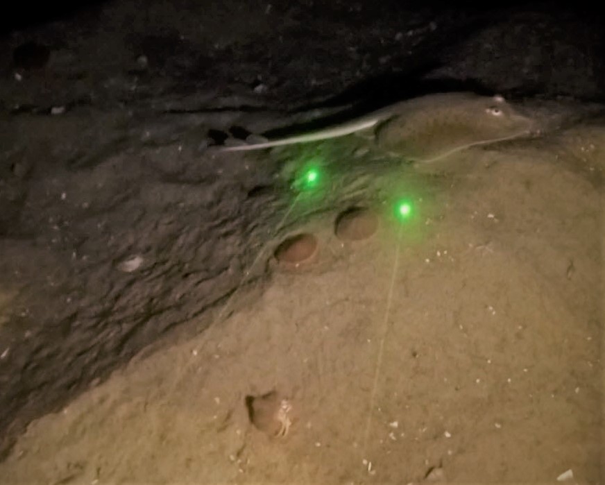
The NOAA National Centers for Coastal Ocean Science (NCCOS) was funded by the Bureau of Ocean Energy Management (BOEM) to conduct a grain size distribution and benthic faunal assessment of the New York Bight on the US Northeast Atlantic Continental Shelf. This information was used to characterize benthic habitats for a site suitability analysis in the New York Wind Energy Area (NYWEA) for the New York State’s Offshore Wind Master Plan. NCCOS mapped the NYWEA using multibeam echosounders for bathymetry and backscatter in the fall of 2017 and conducted a ground validation mission using a modified van Veen grabber in the spring of 2018. 400 in situ samples of the substrate were collected and sorted into phi classes using a sieve shaker to calculate the percent grain size distribution. HD underwater video cameras mounted to the grabber were used to classify the geoform and biotic cover of the seafloor. Video analysis revealed an ecosystem of vast swaths of sandy megaripples, gravel deposits of pebbles and broken shell, and large colonies of foraging common sand dollars (Echinarachnius parma). Little skates (Leucoraja erinacea), Atlantic moon snails (Euspira heros), and other benthic organisms were also observed scavenging or searching for prey across the seafloor. Empirical Bayesian Kriging was used to map the distributions of grain size classes from the sediment grabs and the percent cover of the common sand dollar from the underwater video at each site. The presence of little skates and data from other benthic fauna were too scattered or rare to model precisely. Linear correlations were used to examine the relationship between sand dollar density and environmental variables such as depth, backscatter amplitude, sediment grain size, and geoform type. These geostatistical models quantitatively compare the multibeam imagery with the ground validation data to understand how different environmental variables influence the benthic epifaunal community.