Simulation of large anti-cyclonic eddies generated by westward propagating Rossby waves in the southern Bay of Bengal during the summer Monsoon season 2019
Abstract:
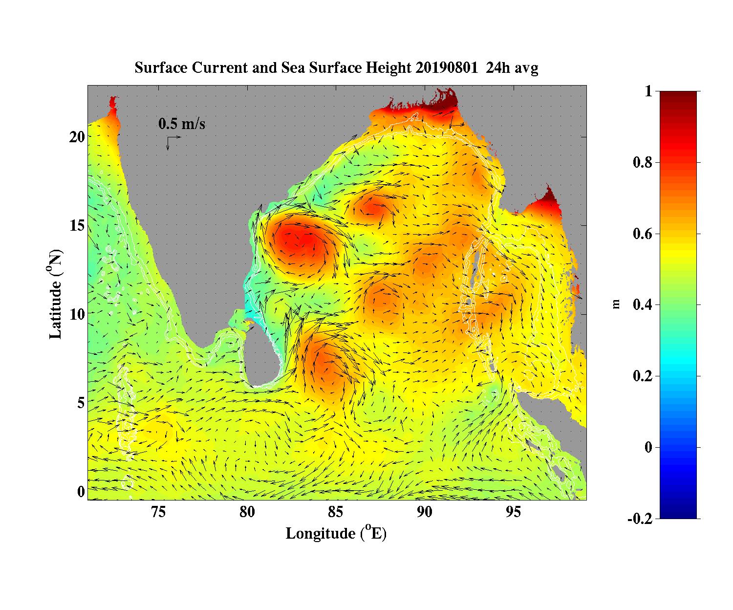
During the monsoon season in 2019 the westward propagating and downwelling Rossby waves were formed along the eastern boundary of the Bay of Bengal from about 5-15N starting in the beginning of June after the onset of the Southwest Monsoon. The southern part of the wave interacted with the Southwest Monsoon Current to form anti-cyclonic eddies. During July a large anti-cyclonic eddy propagated westward to the Sri Lanka coast and spanned the latitude range 4-8N by the end of the month. A relative weak cyclonic Sri Lanka dome was found to the north, squeezed in between the southern anti-cyclone and a similarly intense anti-cyclone to the north between 12-16N and centered along 82E. The circulation near the east coast of Sri Lanka was dominated by the southern gyre that resulted in a strong northward flow into the Bay of Bengal. Currents reached to 800 m with a northward flow of 0.6 m/s at 400 m in the model and were found to have higher speeds and reach greater depths in observations.
During the second half of August, the southern anti-cyclone moved northward while shedding a cyclonic eddy and merged with the northern anticyclone.
The two anti-cyclonic eddies in 2019 dominated the summer monsoon circulation near Sri Lanka causing a predominant northward flow. In contrast, in 2018, a stronger Sri Lanka Dome prevented the migration of the southern anti-cyclone to reach the Sri Lanka coast and the subsequent northward migration and the flow near Sri Lanka was southward.