Leveraging partnerships and unmanned systems to map coastal elevations and nearshore depths
Leveraging partnerships and unmanned systems to map coastal elevations and nearshore depths
Abstract:
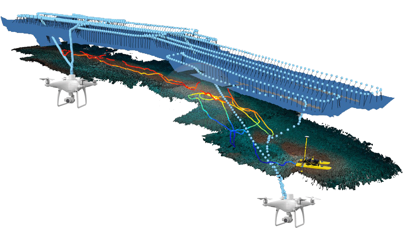
Marine resource managers require imagery, elevation and depth data to inform management decisions in the coastal zone. However, many near-shore areas, especially in remote locations, are difficult to access and expensive to map in the coastal United States. The use of commercially-available unmanned systems (UxS), combined with Structure from Motion (SfM) software, provide an accurate and rapid response tool for NOAA to efficiently fill these information and data gaps. Over the last two years, scientists from NOAA’s National Ocean Service have developed partnerships with other government agencies, academic institutions and private companies to investigate the use of these emerging technologies for addressing coastal data gaps. NOS scientists have worked closely with Oregon State University and Wayne Wright Consulting, with support from the National Park Service, University of California and the Nature Conservancy, to test the use of UxS and SfM technologies in coastal areas, and to develop guidelines for mapping nearshore elevations and shallow-water (<20 m) depths. Several UxS platforms, including unmanned aircraft systems (UAS) and an autonomous surface vehicle (ASV), and various acquisition parameters were tested in two locations, St. Croix, USVI and Santa Cruz Island, CA, under a range of environmental and operational conditions. Data from these two field efforts were used to better understand the environmental limitations and operational challenges of UxS and SfM, and to empirically develop a set of coastal bathymetric mapping guidelines for NOAA. This public-private partnership has helped NOAA scientists better understand how these technologies complement NOAA’s existing coastal mapping capabilities, and advanced ocean research as encouraged by the National Oceanographic Partnership Program.