Offshore Operations Risk Assessment Technology Using Metocean Ensemble Forecasts Results
Abstract:
Since 2014, ITRI has signed an MOU with Central Weather Bureau (CWB), to ensure the offshore metocean forecast and observation data exchange as well as technologies development cooperation. The wave ensemble forecast of CWB is based on the NOAA WAVEWATCH III (WW3) three nesting multigrid model over Taiwan area. The ensemble system consisted of 24 ensemble members and was set with spatial resolutions of 0.25°, 0.1° and 0.025°. The wind forcings are coming from WRF based ensemble forecast system (20 members) of CWB, JMA (Japan Meteorological Agency) and Global Forecast System of NCEP (National Centers for Environmental Prediction). The combination of using two built-in wind forcing formulas to form the ensemble members was proposed (each with 12 members), which can increase the average ensemble spread (SPRD) and decrease the difference between the root mean square error and average SPRD based on the truth value at open seas.
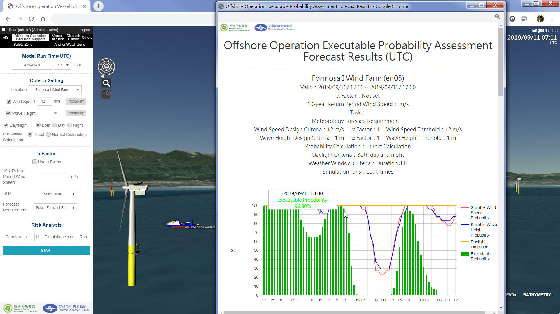
With the establishment of the risk assessment technology, Offshore Wind Turbines Construction and Maintenance Operations Vessels Dispatch and Tracking Decision Support System was constructed with the architecture of the existing metocean simulation technology and the key probability prediction information. Further combined with web-based three-dimensional geographic information system (GIS) and Automatic Identification System (AIS), the vessels dispatch concerning the execution probability of offshore operation can be achived. The risk assessment results will be displayed in table format as well as statistical charts. The real time meteorological observations with statistic data of selected stations can also be displayed.
This article will elaborate the establishment of the offshore operations risk assessment technology and the related system built as well as the metocean ensemble forecasts used in the system.