Megafauna community assessment with cameras: Platform, annotator and methodology comparison
Megafauna community assessment with cameras: Platform, annotator and methodology comparison
Abstract:
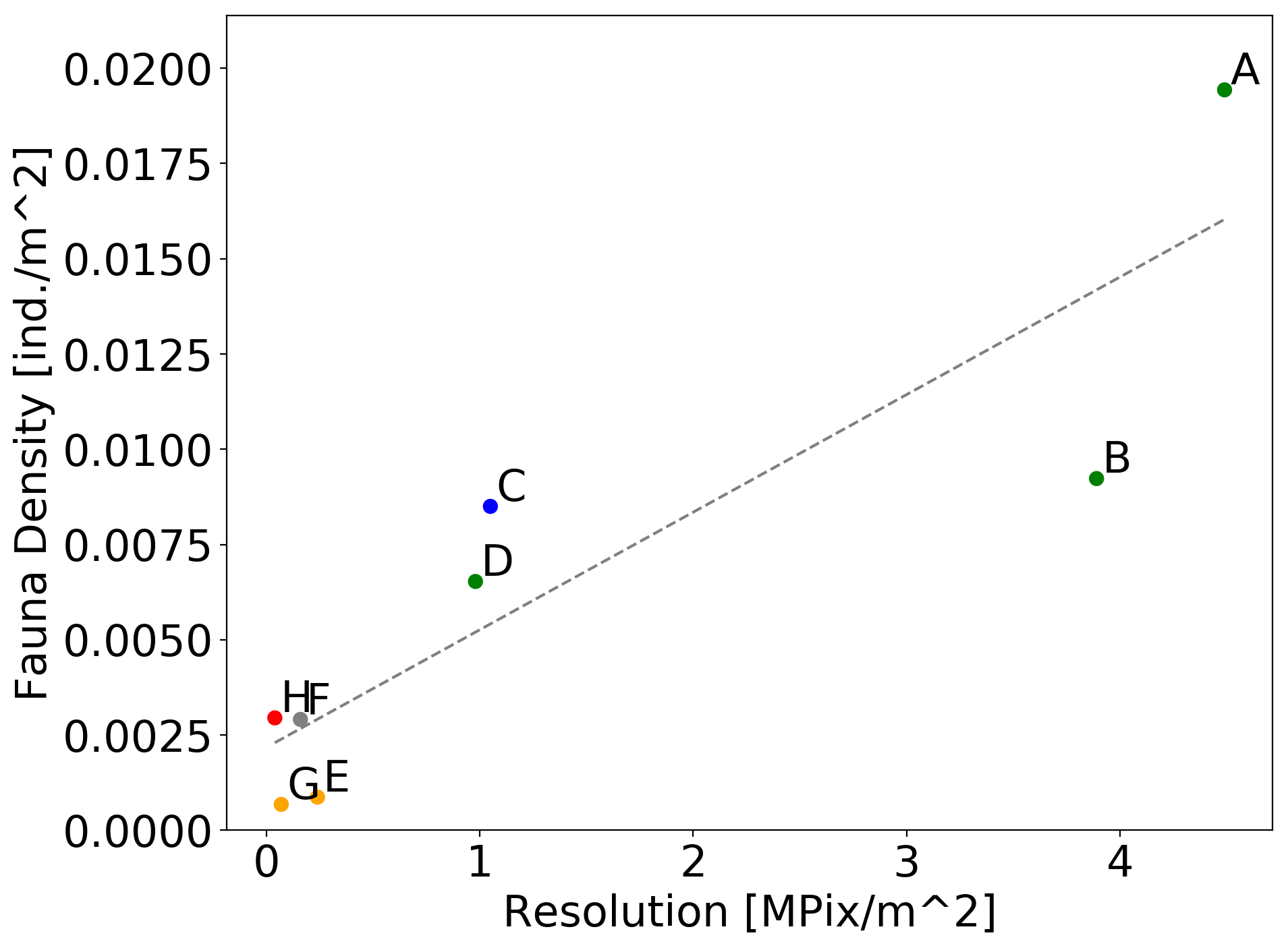
With the mining of polymetallic nodules from the deep sea seafloor again approaching commercial viability, decisions must be taken on how to most efficiently regulate and monitor physical and community disturbance in these remote ecosystems. Image based approaches allow non-destructive assessment of larger fauna abundances to be derived from survey data, with repeat surveys of areas possible to allow time series data collection. At time of writing key underwater imaging platforms commonly used to map seafloor fauna abundances are Automated Underwater Vehicles (AUVs), Remotely Operated Vehicles (ROVs) and towed camera "Ocean Floor Observation Systems" (OFOSs). These systems are highly customisable, with mounted cameras, illumination systems and deployment protocols rapidly changing over time, and even within survey cruises. In this study 8 image datasets were collected from a discrete area of polymetallic nodule rich seafloor by an AUV and several OFOSs deployed at various altitudes above the seafloor. A fauna identification catalogue was used by 5 annotators to estimate the abundances of 20 fauna categories from the different data sets. Results show that for many categories of megafauna differences in image resolution greatly influenced the estimations of fauna abundance determined by the annotators. This is an important finding for the development of future monitoring legislation for these areas. When and if commercial exploitation of these marine resources commences, to ensure best monitoring practice, unambiguous rules on how camera-based monitoring surveys should be conducted, and with what equipment, must be put in place.