Hyperspectral Remote Sensing of Coral Reef Condition: COral Reef Airborne Laboratory
Hyperspectral Remote Sensing of Coral Reef Condition: COral Reef Airborne Laboratory
Abstract:
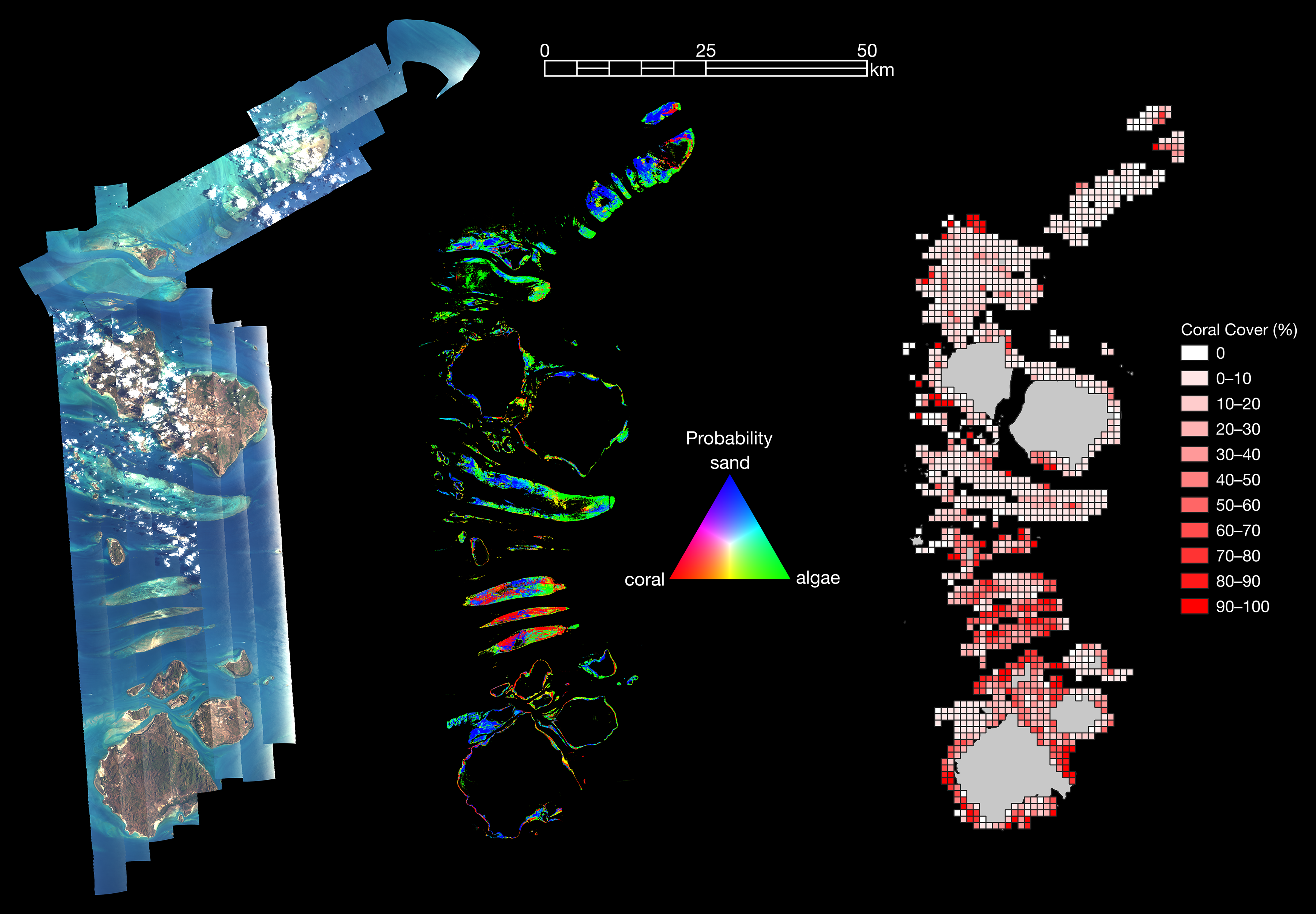
In 2016 and 2017, the COral Reef Airborne Laboratory (CORAL) collected 375 hyperspectral images over the Great Barrier Reef, Hawaii, Mariana Islands, Palau, and Florida. Together, these scenes cover 8,500 km², or about 2%, of the world's reef area, 10–100× the total area previously surveyed. Data have been processed to retrieve composition of the reef benthic community (coral, algae, sand), as well as to model rates of primary production and calcification. This represents, by far, the most extensive uniform survey of reef condition to date. The data do not support many prevailing, simplistic notions of basic reef function: coral cover does not follow expected patterns with respect to temperature stress, light availability, aragonite saturation, coastal development, sedimentation, pollution, or overfishing. More complex, multivariate statistical models (generalized linear models with logistic response functions, as well as bootstrap aggregated regression trees) perform much better, describing 60%–65% of variability in coral cover. That reefs exhibit nuanced, complex responses to biogeophysical forcings should not be surprising, but this is the first study to develop a direct, quantitative model for reef condition. The collection and processing of airborne hyperspectral data make this analysis possible.