MoDesCo: Toward a comprehensive assessment of future coastal risks and hazards in the Estuary and Gulf of St. Lawrence, Eastern Canada
MoDesCo: Toward a comprehensive assessment of future coastal risks and hazards in the Estuary and Gulf of St. Lawrence, Eastern Canada
Abstract:
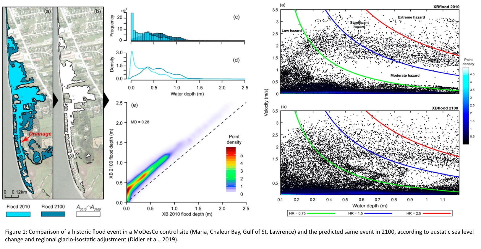
The maritime region of Quebec includes one of the largest estuarine system in the world characterized by seasonally ice-infested waters, connected to the North Atlantic through the Gulf of St. Lawrence. On the low-lying coasts, the intertidal zone is typically large (2-5 km) and flat (β < 0.02), backed by a short, low and reflective beachface (β > 0.10). During extreme events (i.e. concomitant high waves and storm surge), these environments are vulnerable to coastal hazards such erosion and coastal flooding. In order to support coastal risk management and adaptation strategies in a context of sea level rise and spatial reduction in sea ice cover, the Research Chair in Coastal Geoscience implemented the MoDesCo project. It aims to assess the future geographic distribution of flood-erosion events along the Estuary and Gulf of St. Lawrence (EGSL) (present-2100). The project focus on three research axes, shedding light on past, present and future morphodynamics in the EGSL. First, multi-instrumental monitoring are conducted at the regional scale to classify the morphodynamic states of the entire EGSL coastline. Wave-induced water levels, floods, shoreline retreat, morphological variability and beach nourishments are analyzed on various sites, representative of the EGSL environment. Secondly, wave climate models are developed at the regional scale (Wavewatch III®, Tolman et al., 2009) for past, present and future conditions (1980-2100). Historical and extreme scenarios of storms events are simulated with the process-based model XBeach (Roelvink et al. 2009), in a context of sea level rise and wave climate evolution (see abstract figure 1). Lastly, an interactive numerical flood-erosion risks atlas will be created for the EGSL coastlines. This step is determinant in giving the authorities relevant adaption tools for a sustainable management of the coastlines in Quebec.