Overcoming Dimensionality Barriers in Satellite Data to Elucidate Spectral-Spatial-Temporal Trends in the Ocean
Overcoming Dimensionality Barriers in Satellite Data to Elucidate Spectral-Spatial-Temporal Trends in the Ocean
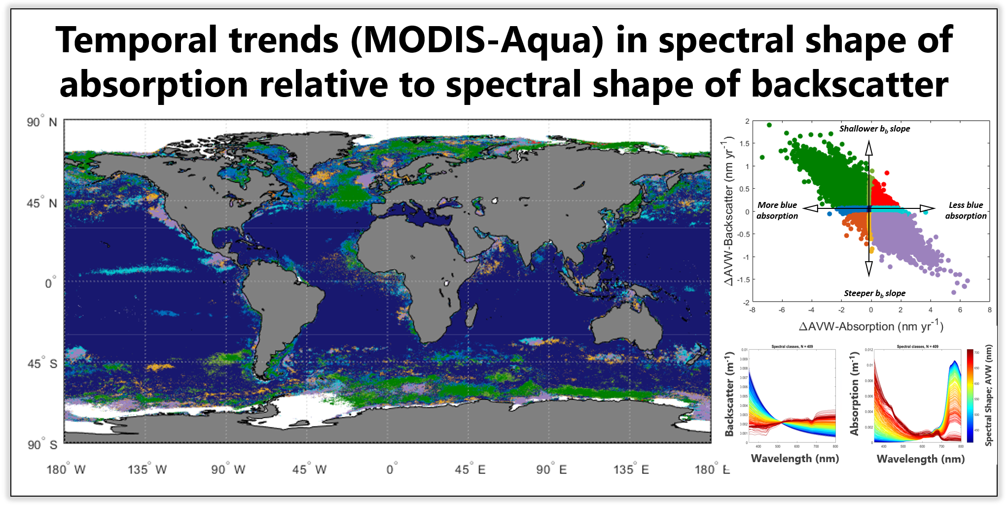
Abstract:
While an era of hyperspectral space-based radiometry is emergent, the comprehensive analysis of even multi-spectral information over time and space remains a formidable challenge, as this requires the simultaneous conceptualization of multiple dimensions of data. Thus, trends in the ocean are typically examined in terms of a single geophysical variable translated from spectral information (e.g. chlorophyll-a, or a single characterizing bio-optical wavelength), but this approach does not maximize the potential of the information embedded in high-dimensional data. In this presentation, we present a dynamic spectral classification technique that quantitatively describes the shape of multi- or hyperspectral datasets along a continuum, enabling a more intuitive visualization and analysis of spectral data in terms of its temporal and spatial variability. Using this approach, we found that over the past 20 years of the satellite remote sensing record, the inherent optical properties of ocean water (absorption and backscatter) appear to experience subtle shifts in terms of spectral shape (Figure 1). The directionality of these trends are not always directly correlated, which may be potentially elucidating planktonic or biogeochemical regime shifts in response to climatic variability. With emerging sophistication in passive and active sensor technology, and presumably concomitant increase in data resolution, we emphasize the importance of utilizing techniques to most efficiently conceptualize relationships between multiple dimensions of data.