Probabilistic Inundation Mapping: Providing ‘Weather-Like’ Forecasts for Flooding
Abstract:
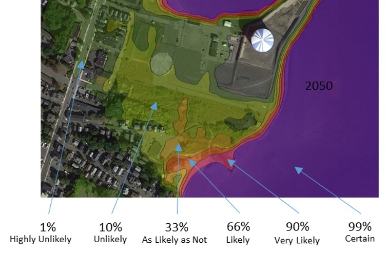
Geoscience Consultants has developed a next-level, FIRM-like mapping product that adds enough granularity to help make risk-based decisions without becoming tied to very specific conditions and/or model results. The technique is based on a normal probability through time of the water surface and the factors that influence the risk such as elevation, and tides; it was originally developed for NOAA to assess uncertainty in water levels. Sine then it has been used in Massachusetts for Northeastern storm level predictions and in South Carolina for monthly tides and infrastructure risks, and for coupled river and coastal risks to target ecological solutions. The outputs are provided in ‘weather forecast’ type graphics, e.g., percentage of occurrence risk during a time interval (year) for each specific location.
Recent work has also begun on mapping the risk of shoreline change in the future, however more work is needed on this as well as exploring ways to normalize input data. As a result of the use of time series input data, the technique is applicable for mapping all types of spatial phenomenon and their future extents.