Identifying Gaps in Bathymetric Coverage in U.S. Deep Waters
Identifying Gaps in Bathymetric Coverage in U.S. Deep Waters
Abstract:
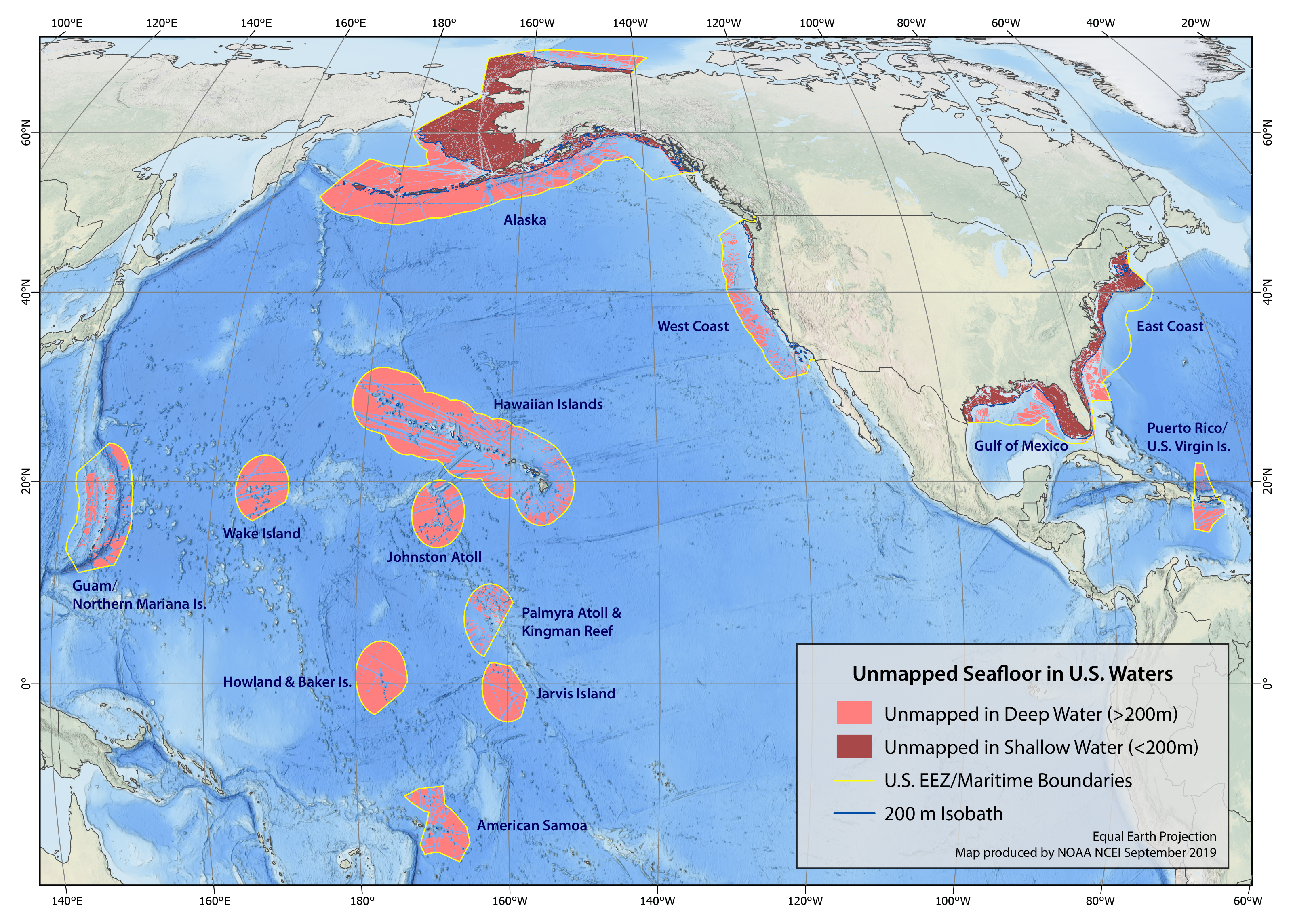
The Nippon Foundation - GEBCO Seabed 2030 project has revitalized international and national interest in ocean floor mapping. NOAA, in cooperation with relevant federal, state and academic partners, seeks to achieve 100% mapping of the U.S. seafloor by 2030. Recognizing the challenge in mapping such an expansive area, coordination of future mapping efforts among various partners will be critical and requires a detailed inventory of existing mapping data. Publicly-available bathymetric data from NOAA and other sources are archived and made available through the IHO Data Center for Digital Bathymetry, hosted at NOAA’s National Centers for Environmental Information (NCEI). NOAA’s Ocean Exploration and Research (OER) program, in cooperation with NOAA’s Office of Coast Survey (OCS), has been focused on mapping the deep ocean seafloor environment (>200m depth), and is seeking out unexplored areas. In 2017, a bathymetry gap analysis of sounding density was produced by OCS, University of New Hampshire Center for Coastal and Ocean Mapping/Joint Hydrographic Center, and NCEI (Westington et al., 2019) to inform an ocean and coastal mapping strategy for U.S. waters and contribute to the Seabed 2030 initiative. Building upon this work, an addendum was produced by NCEI incorporating multibeam bathymetric data acquired since the previous annual update of the gap analysis. Here we provide a synopsis of the current state of mapping of U.S. waters deeper than 200m and describe the GIS workflow to derive the bathymetric coverage polygons and percentage of seafloor mapped. Using this methodology, approximately 49% of U.S. deep waters (>200 m) are shown to be unmapped. We discuss GIS techniques such as calculating accurate geodesic areas and advantages/disadvantages of a polygon-based vs. raster-based approach.