Quantitative, Non-destructive Estimates of Coarse Root Biomass using 3-D Ground-Penetrating Radar (GPR)

Joe I Boyce, Muhammad Altaf Arain, Michelle Molon and Doug Blomfield, McMaster University, School of Geography and Earth Sciences, Hamilton, ON, Canada

Contact First Author: Joe I Boyce; boycej@mcmaster.ca

Abstract ID#: 36723


English Abstract:
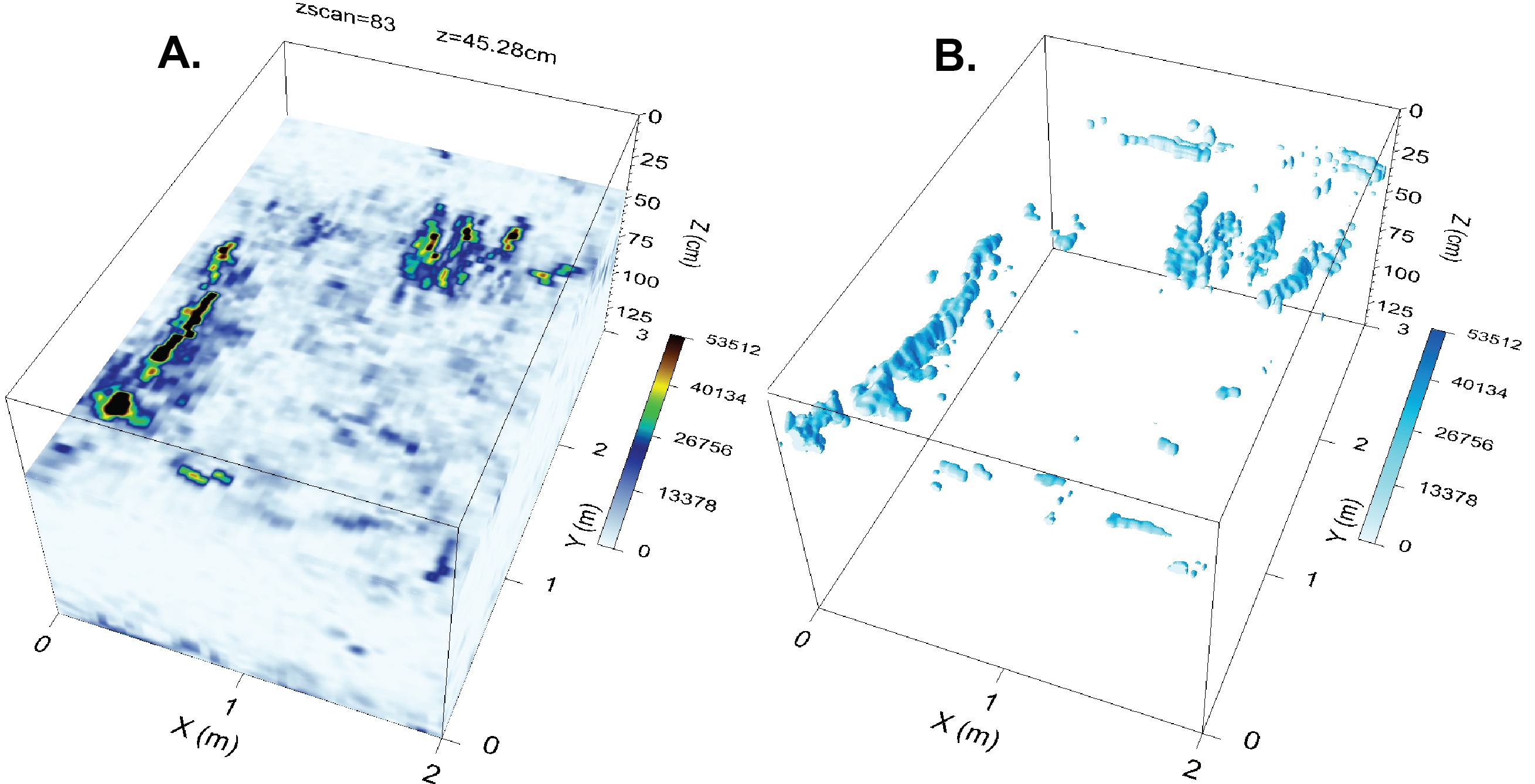
Tree root biomass is an important component of carbon storage in forest ecosystems. In this study, we evaluated 3-D imaging of root structure in a temperate pine forest in southern Ontario, Canada using high-resolution (1-GHz) GPR with post-survey corrections for surface micro-topography. A MEMS (micro-electro-mechanical systems) accelerometer was used to record antenna motions and to calculate the transmit beam vector. Surveys were performed across a 2 x 3 m calibration pit (5 cm line spacing) containing reburied root segments and a 400-m2 forested plot (12.5-25 cm line interval). Radargrams were corrected for beam angle, migrated and interpolated to a quasi-3-D volume using an inverse distance algorithm. Root volume and biomass were estimated from isosurfaces calculated on Hilbert-transformed GPR amplitudes using a marching cubes algorithm.

The forest floor micro-topography induced significant antenna tilt (pitch > 45°, roll > 28°) and yaw (up to 10°), leading to errors in the positioning of root diffraction events in 3-D radar volumes. The corrected vector migrated GPR amplitudes showed a 15.5% amplitude increase and improved imaging of root structures due to focusing of diffraction energy. Radial scanning produced superior root imaging and continuity due to the larger number of root crossings when compared to rectilinear survey grids. Isosurfaces calculated on Hilbert-transformed amplitudes provide a rapid means of quantifying the root diameter and total biomass volume. Estimation of root biomass requires high inline sampling and line density (< 5 cm). Estimates of belowground carbon using a multi-channel GPR with small inter-line spacing could provide a viable approach for surveying large test plots and could be employed to further refine and validate ecosystem models.