Ocean Warming of Petermann Fjord and Glacier, North Greenland
Abstract:
Our ocean data cover the entire 2002-2015 time period when we find statistically significant changes of ocean properties in space and time. The ocean under the ice shelf connects to ambient Nares Strait and to the grounding zone of the glacier at daily to weekly time scales via temperature and salinity correlation. More specifically, we find 1. substantial and significant ocean warming of deep fjord waters at Interannual time scales, 2. intense and rapid renewal of bottom waters inside the 1000-m deep fjord, and 3. large fluctuations of temperature and salinity within about 30-m of the glacier ice-ocean interface at daily to weekly time scales.
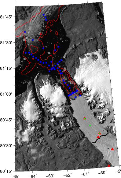
Figure: Map of the study area with 2015 locations of CTD casts (blue and green dots), ocean-weather stations (green dots), and differential GPS (red triangles). Red contours are bottom depths at 500 and 1000-m while thick black line indicates the grounding zone where the glacier connects to the bed rock below.