Effects of mudflats and stratification on surface tidal currents near the outflow of the Fraser River, British Columbia
Abstract:
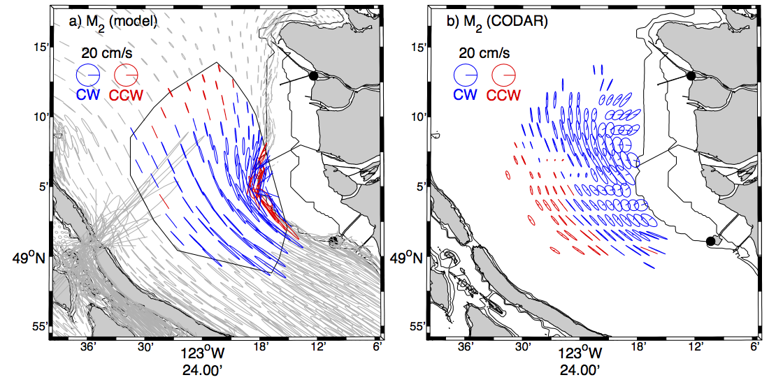
Here, we 1) summarize the HF radar surface observations, focusing mostly on the largest constituent, M2, 2) compare them to the observed and modelled water column and barotropic tides, and 3) identify what causes the differences. We will show that the presence of the Fraser River, which is embedded in an environment which is otherwise tidally unremarkable, can account for some of the key observed surface tidal features. The delivery of sediment to the coast by the river has built up extensive mudflats, which alter the magnitude and orientation of the local tidal ellipses. Furthermore, the shallow mudflats and steady river outflow generate shallow water constituents and potentially alter the phase of M2 in adjacent waters. Finally, fresh water from the river creates a highly stratified surface layer, decoupling it from deeper layers and allowing for the possibility of internal tides which can then interfere with the barotropic tide.