Seagrass Mapping and Density Estimation Using a Drone System – A Case Study in Futtsu Tidal Flat of Tokyo Bay, Japan
Seagrass Mapping and Density Estimation Using a Drone System – A Case Study in Futtsu Tidal Flat of Tokyo Bay, Japan
Abstract:
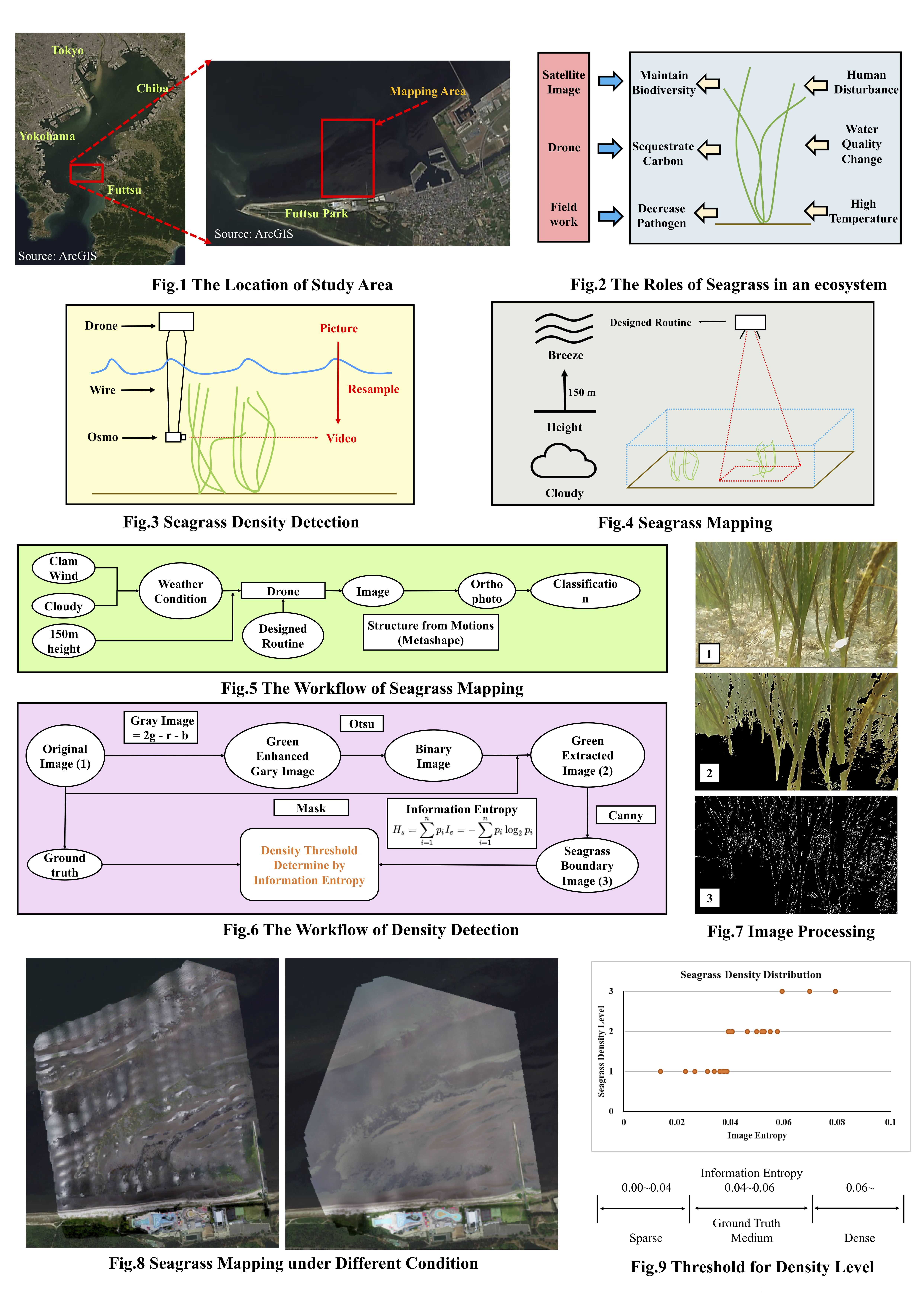
Seagrass ecosystem plays a vital role in coastal ecosystems, including a function of carbon sequestration called blue carbon to contribute to mitigating climate change. Traditionally, seagrass detection is conducted by field survey, satellite image and airborne machine. Promising but limited, seagrass mapping and density detections using drone in intertidal area are facing challenges: water turbidity, sunshine halation and waves precludes on classification accuracy, shoot density is hard to measure accurately. In order to solve the problems, a more accurate and easier way for mapping and density estimation is supposed to develop by using drone with camera and then this method was conducted in Futtsu Tidal Flat of Tokyo Bay, Japan. For mapping, several trails for selection of optimal weather condition and drone height were conducted, and ground truth data was obtained with GPS.Vertical seagrass photos in the water were collected by immerging camera tied to an iron wire hanging under drone into the seawater. After collecting, resampled pictures captured from camera recorded video was processed through several procedures including green part extraction, canny algorithms, and information entropy calculation. Software Metashape was used to merge the seagrass ortho-photomosaic. Visual interpretation was applied for both determining the ranges of seagrass density level from original image and classification of seagrass in the ortho-photomosaic picture. Results show that firstly, according to the ground truth data, accuracy of visual interpretation classification for seagrass in intertidal areas is relatively high under the condition of 150-m flying height as well as cloudy and clam wind weather.Secondly, a density level threshold based on information entropy from vertical photos can be employed for seagrass density level estimation. It is easier and more accurate compared with density inversion from Leaf Area Index (LAI) estimation.