Managing US National Park Service Resources on Barrier Islands in Action: Cape Lookout and Cape Hatteras National Seashores after Hurricane Dorian
Rebecca Lenel Beavers1, Robert S Young2, Katie McDowell Peek3, Blair Tormey3, Henry T. Crawford4, Margo Schwadron5, Tim Smith6, Mark Ford7, David Hallac8 and Jeffrey West9, (1)National Park Service Denver Service Center, Denver, CO, United States, (2)Western Carolina Univ, Cullowhee, NC, United States, (3)Western Carolina University, Cullowhee, United States, (4)Environmental Stewards, Lakewood, United States, (5)National Park Service, Tallahassee, United States, (6)National Park Service, Lakewood, United States, (7)National Park Service, Baton Rouge, United States, (8)National Park Service, Manteo, United States, (9)National Park Service, Harkers Island, United States
Abstract:
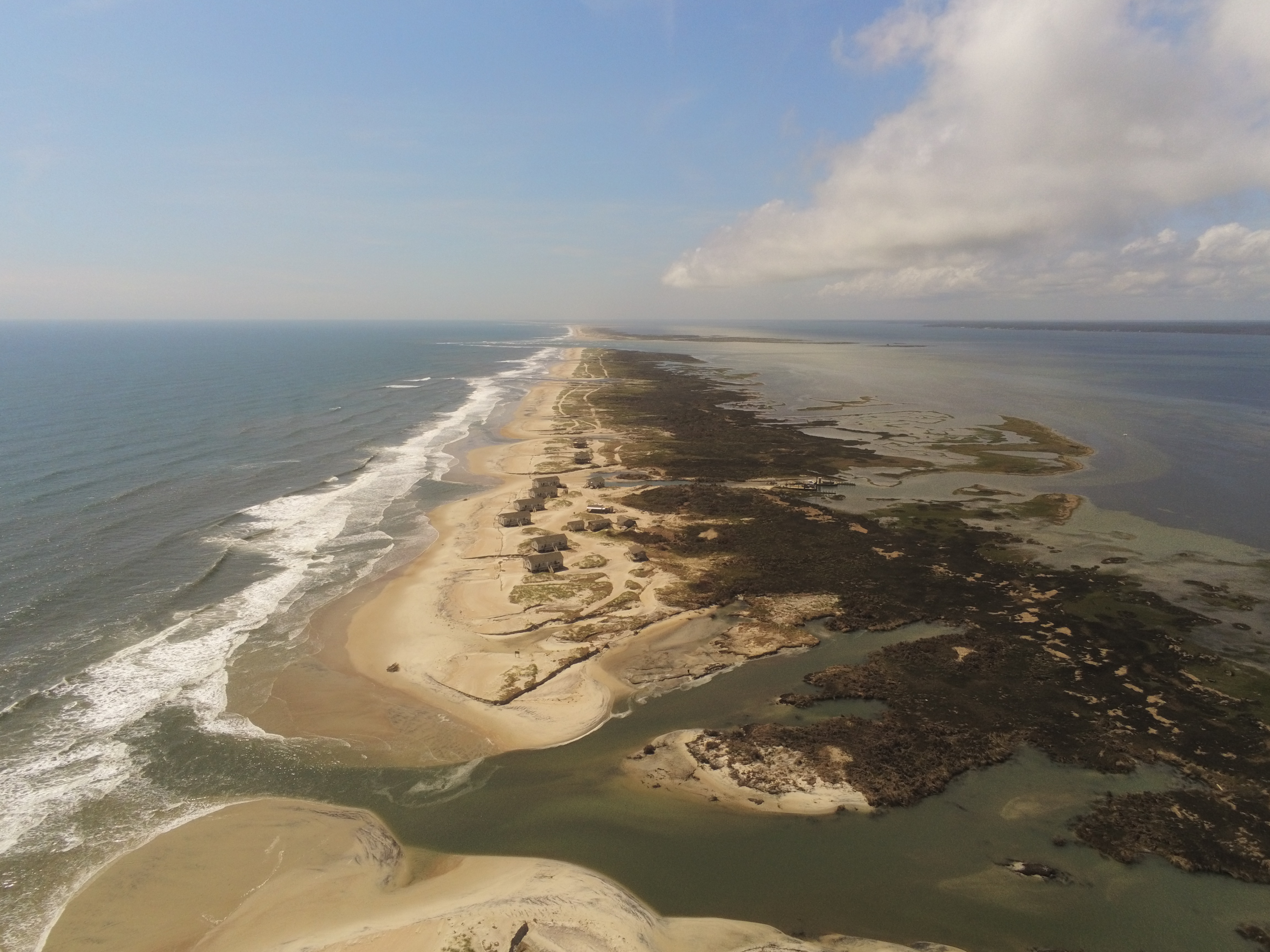
On September 6, 2019, Hurricane Dorian impacted two National Seashores managed by the National Park Service. In Cape Lookout National Seashore, more than 90 ebb surge channels formed along the 28.5 km of North Core Banks (per Sherwood et al. this session). A large amount of this eroded sediment was deposited into small ebb deltas and was transported to the adjacent beachface in the weeks and months following Hurricane Dorian. This process ultimately created deep water pools as documented by overflights from USGS, NOAA, and Western Carolina University. Similar pond formation in other barrier island systems have persisted for decades, often supporting a wide diversity of fishery species as well as rich plant communities. A Northeaster storm in 2019 reopened many of these channels through overwash from the Atlantic Ocean side of the barrier island. Between damage to cabins at Long Point (see photo) and truncated access via beach driving, park operations and visitor access remain impacted as of November 2019.
38 historic structures and associated archeological resources in Portsmouth Village Historic District were impacted by Hurricane Dorian’s winds and the highest ever measured storm surge. NPS staff surveyed the surge of 4.9 ft. (1.495 m)* above the elevation of the NPS survey monument, CALO1 (PID DN6752) in Portsmouth Village. Additional field work was completed to reoccupy benchmarks, collect ground control points for aerial overflights, and document the condition of archeological resources. 43 treefalls were recorded at Portsmouth Village and are a visible component of the landscape transition from maritime forest towards wetlands ecosystems.
Cape Hatteras National Seashore also sustained major flooding that caused damage to the Ocracoke Light Station and associated historic structures on Ocracoke Island. The most severe storm surge flooding occurred in the village of Ocracoke where several people required rescue by boats. Of particular concern to Ocracoke residents and visitors was the limited access via ferry and along Highway 12 east of Ocracoke toward Hatteras Inlet and Hatteras Island; this access to Hatteras Island was interrupted for months.
* Based on highest water height (1.944 m), 11:36 AM LT on Sept. 6, 2019 at 8654467 USCG Station Hatteras, NC.